 vesseltracker.com
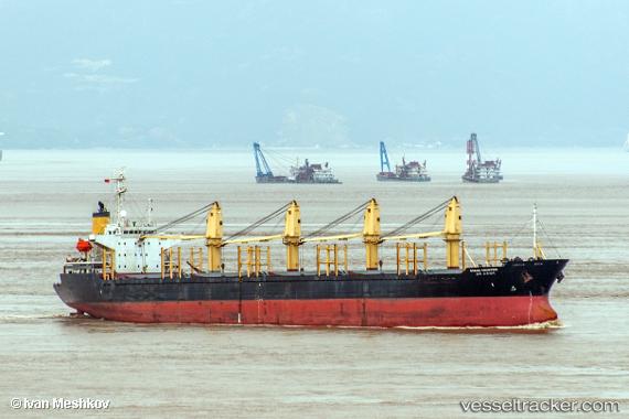
Vessel LUCKY STAR IMO: 9140047, MMSI: 511900000 Bulk Carrier
UTC, 17.58854, 132.92331, course: -1, speed: 9.1
UTC, 17.58854, 132.92331, course: -1, speed: 9.1
2026-02-24 19:15:28 UTC, 18.41671, 132.27074, course: -1, speed: 9.9
Live AIS position:
UTC. Open sea, approx. 545 nm off the nearest listed port),
updated 2026-02-24 19:15:28 UTC.
Find the position of the vessel LUCKY STAR on the map. The latter are known coordinates and path.
marine traffic ship tracker show on live map
The current position of vessel LUCKY STAR is 18.41671 lat / 132.27074 lng. Updated: 2026-02-24 19:15:28 UTCCurrently sailing under the flag of Palau (Republic of)
LUCKY STAR built in 1996 year
Deadweight:
28387 tDetails:
Last coordinates of the vessel:
UTC, 17.58854, 132.92331, course: -1, speed: 9.1UTC, 17.58854, 132.92331, course: -1, speed: 9.1
UTC, 17.58854, 132.92331, course: -1, speed: 9.1
2026-02-24 19:15:28 UTC, 18.41671, 132.27074, course: -1, speed: 9.9